The central element around which much of the activity of a team of researchers, technologists, and technicians from INGV has been developing for years is extending and integrating the monitoring networks developed on land with observation points at sea in strategic sites. Having observation points at sea allows us not only to analyze geophysical phenomena from a different perspective but also to increase our understanding of the complex processes of land-ocean-atmosphere interaction. Thanks to the acquisition of long time-series of data, underwater observatories play a fundamental role in monitoring a wide range of natural processes, from the occasional short-time scale ones (such as earthquakes and tsunamis) to those that exhibit long-term variability period (for example the warming of the seas).
From the 1990s to today, a multi-parameter submarine observatory, the first of its kind in Italy and in Europe, has been developed and has seen numerous evolutions and applications over time. In its latest version, thanks to an electro-optical cable that connects it to a ground station, the continuous power supply of the instruments installed on the observatory is guaranteed as well as the real-time transmission to the ground station of the data recorded at sea. This therefore also allows their immediate ingestion in a dedicated database and their use by researchers. Thanks to a GPS receiver installed in the ground station, all data from the observatory are synchronized in time, thus allowing researchers to make it easier to compare different measurements. Using the broadband connection provided by the GARR consortium, a copy of the data is transferred for redundancy/security to other servers at the INGV headquarters in Rome.
The database has recently been enriched with water column data recorded by an oceanographic mooring, installed near the observatory, to integrate the information necessary to understand the processes that characterize the deep dynamics and their variability.
The multidisciplinary data acquired by the observatory concern various scientific fields:
- Seismological: obtaining data from an offshore measurement site for a better description of submarine seismicity;
- Geohazard: monitoring for the tsunami and for the detection of submarine landslides through the signals recorded respectively by the absolute pressure sensor and by the seismometer;
- Oceanographic: for the study of local dynamic processes and monitoring of essential marine variables at the seabed (e.g. temperature, salinity, marine currents, pCO2, marine particulate matter, etc.)
- Environmental: monitoring of underwater acoustic noise in the bands of interest indicated by the Marine Strategy Framework Directive (MSFD) of the European Parliament (2008/56/EC) which identifies man-made acoustic noise as an important indicator in defining the "good environmental" of a marine ecosystem;
- Biological: detection and tracking of cetaceans obtained from the analysis of acoustic signals measured at great depths;
- Volcanological: detecting the activity of Etna seen from seismometer, gravimeter and hydrophones data, and activity seen on data from oceanographic sensors (for the observatory located in front of Catania);
- Geomagnetic and Gravimetric: for the study of the variability of the earth's magnetic field and of the variations in gravity due to the earth's tides.
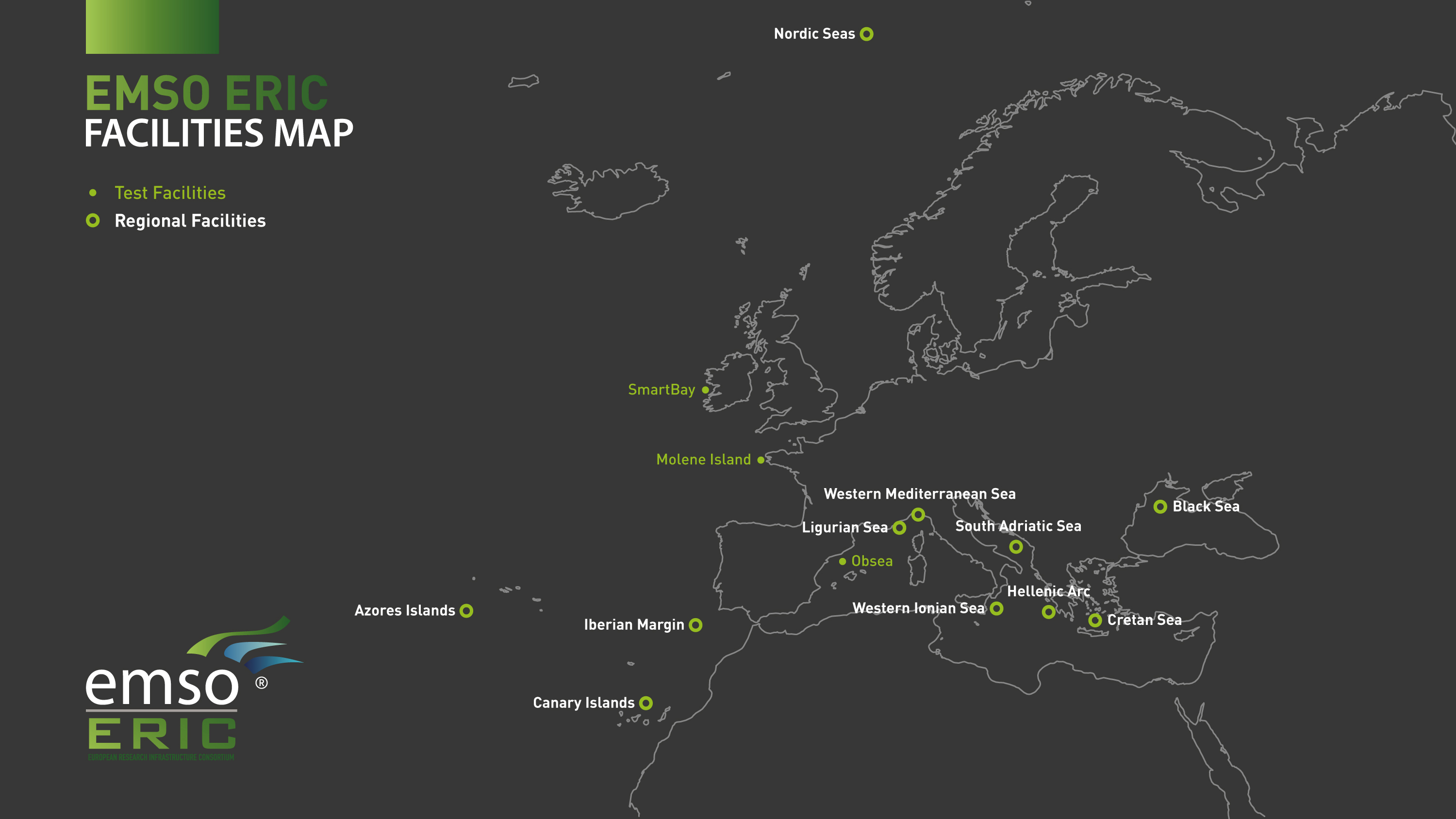
The whole of underwater observatories, mooring, and all the services necessary for their functionality make up the Western Ionian Sea infrastructure. This is one of the infrastructures of the European Consortium EMSO, European Multidisciplinary Seafloor and water column Observatory.
.
EMSO coordinates different observation nodes operating in European seas from the Arctic to the Northeast Atlantic Ocean to the Black Sea via the Mediterranean. EMSO provides continuous geophysical, oceanographic, and biological time series observables with the aim of contributing to the understanding of the phenomena that take place in the deep sea and of the complex interactions between the geosphere-biosphere-hydrosphere
 Fig. 1 EMSO ERIC observatories’ map

